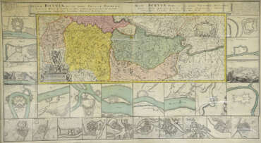
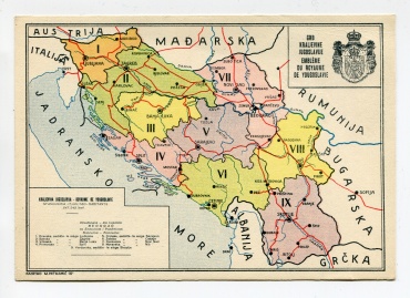
The collection contains various materials which, in addition to the territory of the city of Jagodina and the Pomoravski district, include a wider area (territory of the Republic of Serbia, Kingdom of Serbs, Croats and Slovenes/Yugoslavia, socialist Yugoslavia, territory outside the mentioned state creations). The period from the 18th to the 21st century is covered. The collection includes: geographical maps, historical maps, topographic maps, silent maps, maps, geographical and historical atlases, tourist maps, road maps, newspaper texts, archives. The oldest map in the collection is the Map of the Austro-Turkish War 1716-1718 (author Johann Fr. Etinger), printed in Nuremberg (Germany) in 1737. Intresting item is the map of the Velika Morava Basin, created in the period 1899-1914 and published by the bookstore “Rajković and Ćuković” from Belgrade. It is important to mention the Plan of the electric network of the town of Jagodina from 1927. The collection also includes various types of plans for Svetozarevo and Jagodina.